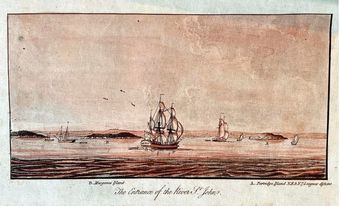
Twenty years and ₤100,000 was spent in the 1700s making a monumental book of beautiful maps and pictures of the coasts of North America called ‘The Atlantic Neptune.’ Only 120 copies of the massive, legendary, rare book survive, three of which are hidden away in New Brunswick’s ornate Legislative Library’s vault.
The New York Public Library called The Atlantic Neptune “one of the most remarkable products of human industry which has ever been given to the world through the arts of printing and engraving.” More than a mere set of maps, it contains an impressive array of colourful and intricately detailed artwork to accompany its innovative navigational guide for ships.
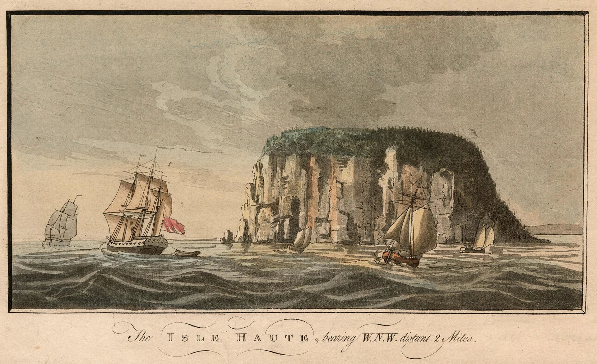
Historian J. C. Webster said: “Apart from the practical value of The Atlantic Neptune, the artistic excellence give it high rank. This feature is solely due to [its creator] DesBarres. He drew with great sensitiveness and had an exquisite sense of colour … of the highest quality.”
Joseph Frederick Wallet DesBarres’ youth is somewhat mysterious, likely intentionally so. It’s thought that he deliberately obscured his own past in an effort to better fit in the British Navy later in life – which could be understandably awkward as a Frenchman at a time when Britain and France were at war.
He was probably born in either Switzerland or France around 1721. His father was thought to have been a Minister in the persecuted Huguenot religious minority.
According to family legend, in his youth, the by-all-accounts rather quarrelsome DesBarres was bullied. He challenged one tormentor to a duel and killed him. He then dramatically fled Switzerland, swimming across a river to safety. After fleeing to Paris, he met an aging Voltaire.
In his early 30s, DesBarres moved to England and joined the Royal Military Academy, where he studied surveying and mapmaking.
At the age of 34, DesBarres sailed to Cape Breton with the Royal American Regiment and joined in the battle over a French fortress that was thought to be invincible: Louisbourg. He and a young officer serving under him named James Cook distinguished themselves by capturing a French entrenchment during the battle.
Soon after the British victory at Louisbourg, DesBarres sailed with General James Wolfe to Quebec, where he made many of the plans that were later used to capture the French capital. He claimed to have been at General Wolfe’s side when he died in the Battle of the Plains of Abraham.
DesBarres returned to Nova Scotia (which New Brunswick was then part of) where he was with Jonathan Binney when he hosted an assembly with Mi’kmaq chiefs, ultimately resulting in the Peace and Friendship Treaties.
In 1763 DesBarres accepted a job other officers had rejected; mapping the coasts of Atlantic Canada in great detail.

This was an arduous task. Maps then were still being made in much the same way as the Ancient Greeks did thousands of years earlier. They were plagued with inaccuracies, one Royal Cartographer called “the common scandal of their badness.”
For ten years, DesBarres worked on his massive project using the latest scientific methods to create the first accurate maps. Lacking staff, he hired local Acadians to help, as they were familiar with inshore waters. After his efforts to have the British Navy pay the Acadians were rejected, he paid them from his own pocket.
After ten years, DesBarres took his notes to England to have them published. He was quickly sent back – a revolution was brewing in America and accurate naval maps were desperately needed.
He spent the next decade with a large team of 33 assistants and a vast amount of resources at his disposal, mapping out the coasts from Labrador to Florida.
This became The Atlantic Neptune.

When eventually published, it was a massive, hefty beast of a book, the size of a coffee table. New Brunswick’s copies require two archivists to carry one out of the vault.
The images are intricately drawn and hand coloured, the artwork painstakingly carved into massive pieces of copper. The maps were interjected with drawings of the coast and cities, seen from sea level, and embellished by adding boats, houses, and even people.
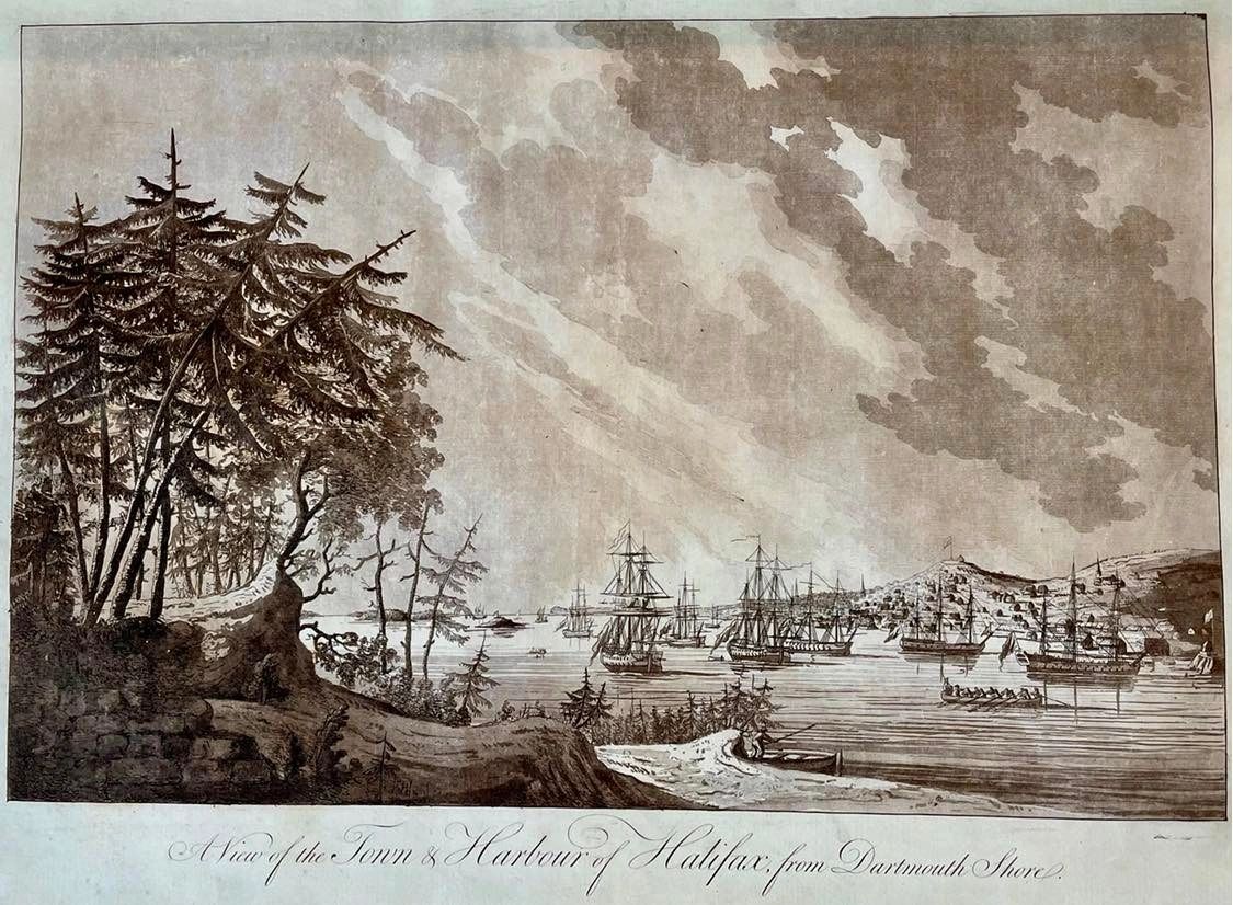
A team of artists spent six years painstakingly carving the 257 pages of DesBarres’ drawings into the massive copper plates, which were later illustrated.
DesBarres had an agreement with the British Admiralty that he could sell the Atlantic Neptune to both the Navy and the public. This is why cities and coastlines are depicted from sweeping aerial views which are dramatic and aesthetic, though would be of greater use to a ship captain if they were from sea level.
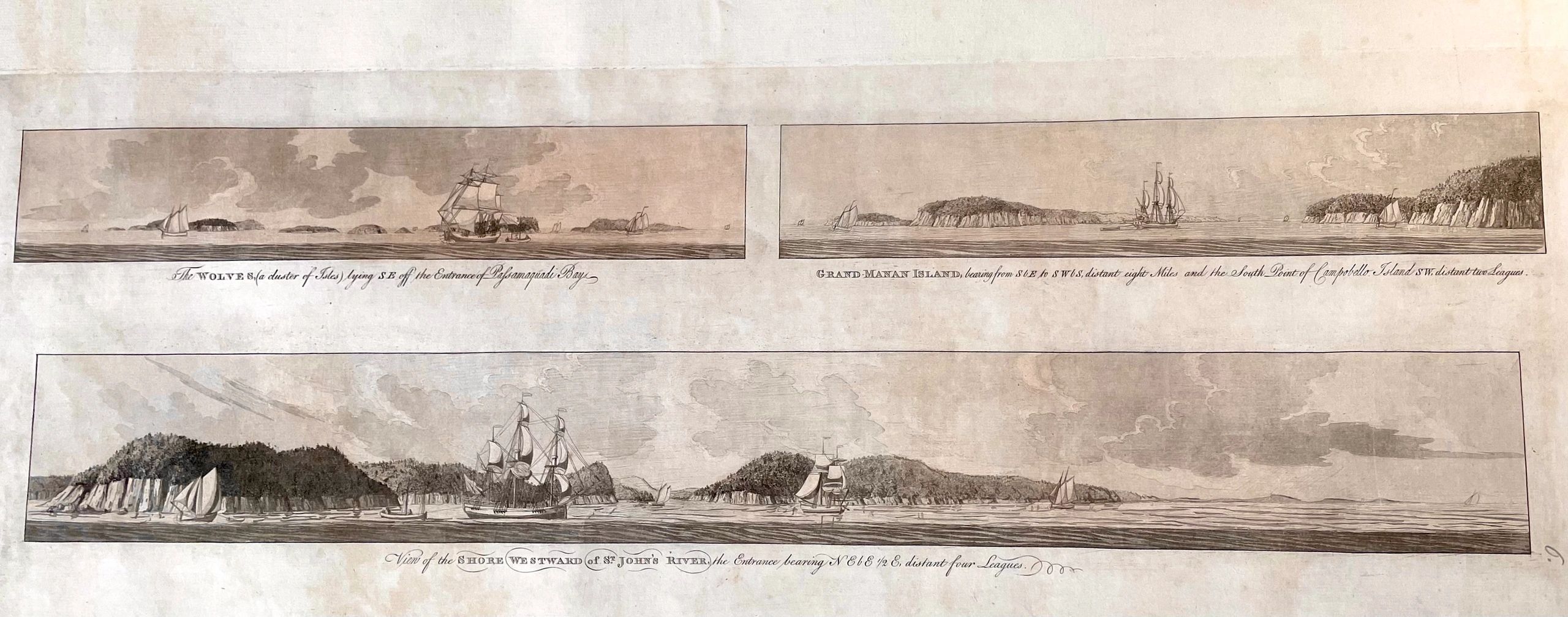
Unfortunately, the intricate art made The Atlantic Neptune vastly more expensive than the public could afford. A series of letters survive recounting how DesBarres went to the Netherlands to try and sell the Atlantic Neptune, where, despite lowering his prices, he couldn’t find any buyers.
DesBarres claimed The Atlantic Neptune not only cost him 20 years of his life, but £58,000 more than he’d been paid. Nonetheless, he wrote: “When the author reflects that the accuracy and truth of his Work will stand the test of ages, and preserve future Navigators from the horror of shipwreck, he does not repine its having employed so large a portion of his life.”
Later, DesBarres became Governor of Cape Breton, where he founded Sydney and butted heads with authorities in Halifax who he felt were holding back the island’s development.
With Sydney facing a winter of starvation, DesBarres traded all his originals of The Atlantic Neptune to a merchant sea captain for a supply of food for the colony.
The combative DesBarres later launched lawsuits to get the money he was owed.
Decades later, in his 90s, he finally won, getting not only his money but also the originals he had traded.
It was said that at his 100th birthday party, he got up on a table and danced a jig.
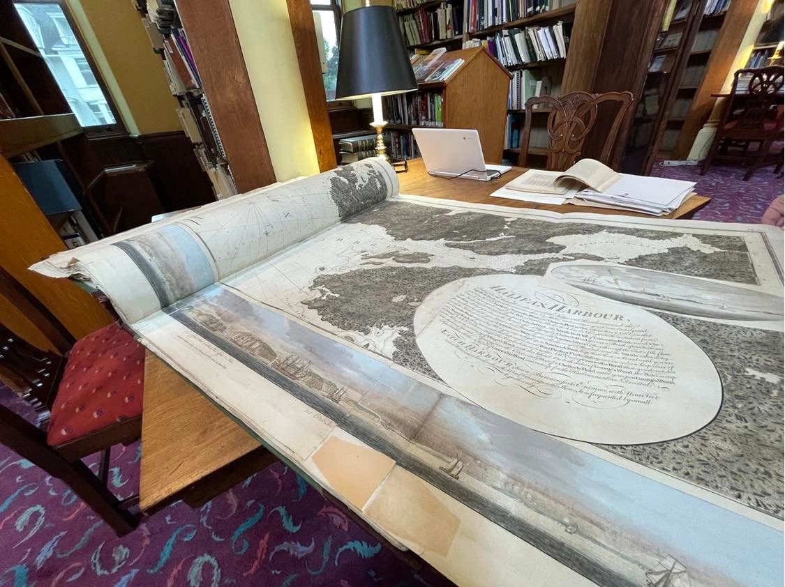
While American copies of the Atlantic Neptune have toured across the United States, generating extensive interest from the media and the public, New Brunswick’s three copies of this important work are kept in the Legislative Library’s vault.


